The GDH LidArc Initiative is a research consortium fully funded by the Hitz Foundation with a $20 million grant from 2025 to 2030 (https://www.hitzfoundation.org). The initiative aims to support underfunded projects in Europe, Africa, Asia, and the Americas [CEG*18], where possible, in the acquisition, processing, and interpretation of high-quality LiDAR data for archaeological research. This research group supports both large-scale (airborne-based) and smaller-scale (drone-based) acquisitions for consortium members, including Global Digital Heritage (GDH), the University of Siena, Tulane University, the University of Texas at Austin, and the Bruno Kessler Foundation (FBK). However, it also supports projects worldwide, extending beyond the consortium’s scope. The broader goal is to select projects that reduce inequalities in access and yield significant discoveries. Interested groups worldwide will submit proposals for research projects, which the consortium will review. The consortium will then conduct data collection and analysis, all of which will be funded by the consortium. All Consortium partners will aim to assist colleagues worldwide in acquiring LiDAR data. Initially, the focus will be on developing seminal case studies in Italy, Costa Rica, Mexico, the Peruvian Andes, the Western Amazon, South Africa, Kenya, and Tanzania (Figure 1).
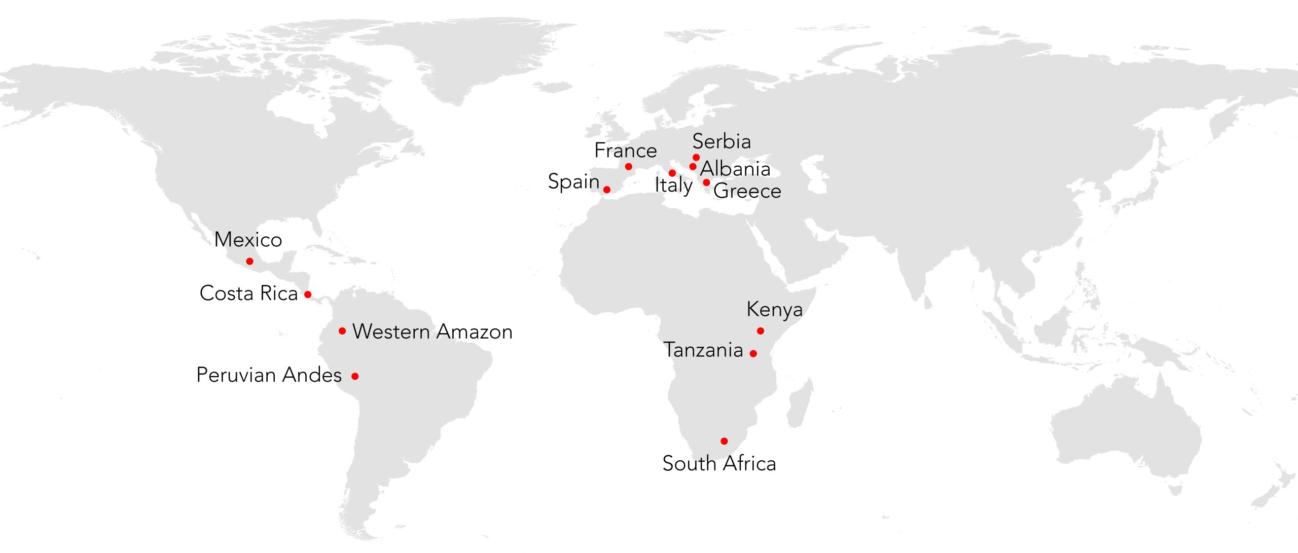
Figure 1: Map of the LidArc Initiative’s first case studies includes Italy, Costa Rica, Mexico, the Peruvian Andes, the Western Amazon, South Africa, Kenya, and Tanzania.
Case study
1.1. South Tuscany-Italy
The southern Tuscan landscape has been shaped by past societies since prehistory, leaving behind a vast amount of archaeological evidence. Much of the territory is now covered by forests, encompassing coastal areas, valleys, uplands, and Mt. Amiata. Since the late 1970s, the University of Siena has been leading research activities in the region, accumulating a comprehensive database (CAMPANA 2018). This historical landscape encompasses urban, village, and agricultural landscapes, as well as three distinct forest canopy types, ranging from open woodlands to the typical Mediterranean forests with dense scrub (CAMPANA 2018; CIRIGLIANO et al 2025). This area is well known for Prehistoric, Etruscan, Roman, and Medieval remains, but it is also known for hundreds of unmapped sites, poorly mapped Medieval villages, and new discoveries every year. In winter 2026, the University of Siena, GDH, and FBK will lead a massive LiDAR acquisition of approximately 5000 km2. LiDAR airborne scanning will have a ground resolution of 50 points/m2. This sample area would be the largest high-resolution area ever undertaken in Europe or Asia, with archaeology as the primary goal. This project would give us the data necessary to determine if extremely large-scale LiDAR projects can be successful in human-engineered landscapes (as opposed to jungles; CAMPANA et al 2025).
1.2. Costa Rica
Tulane University team will lead the acquisition of five large areas of Costa Rica. The primary objective of this lidar campaign is to investigate ancient settlement distributions related to the emergence of complex societies, specifically cacicazgos and chiefdoms. The campaign focuses on two regions with prominent surface architecture that have not yet been studied using lidar, as well as three less-explored regions that may reveal previously undocumented sites. These sites could provide important insights into the development of social complexity and interregional exchange. In particular, focus will be on Linea Vieja Region (ca. 350 km²), Guayabo de Turrialba (ca. 100 km²), Osa Peninsula (ca. 200 km²), Río San Juan (ca. 250 km²) and Santa Rosa (ca. 100 km²).
1.3. Mexico
Research activity in southern Mexico will be led by the University of Texas at Austin team and will focus on the historically attested, Chontal-speaking eastern Acalan Maya and the Desempeño watershed. The proposed survey area encompasses the northern and central regions of the Balam Ku Biosphere Reserve. In the northwestern sector of the reserve, the area encompassing the Desempeño watershed represents a zone of remarkable ecological and archaeological interest. As one of the least explored regions within the greater Calakmul landscape, this area holds the potential to provide critical insights into both the environmental dynamics of the Maya Lowlands and the historical processes that shaped the cultural frontier between Maya polities and colonial forces during the Late Postclassic and early colonial periods. Data collection for will occur in 2026 or 2027, depending on the availability of the National Center for Airborne Laser Mapping (NCALM), the preferred provider of lidar data in the Maya Lowlands. At current rates, we plan to acquire around 700 km2 of data.
1.4. Peruvian Andes
The University of Texas at Austin team will lead a large acquisition in the eastern Andes. This project explores the eastern Andean slope, including areas to the north and northeast of Cusco, with planned lidar data acquisition scheduled for late 2025 or early 2026. Overall, this region is important for understanding the interface between the Andean and Amazonian worlds, which have very different landscapes, indigenous languages, and subsistence practices. The data acquisition will be divided over two areas. One will be north of Cuzco in the mountains near Machu Picchu where the Inca were known to be growing tropical crops at their country palaces. The second will be northeast of Cuzco in the greater Paucartambo region and the upper Amazonian region below it. We expect that LiDAR would reveal evidence for the tropical expansion of the Incas, as well as potentially how nearby Amazonian people developed the Andean foothills, which is another major frontier in South American archaeology for which we have almost no information.
1.5. Western Amazon
Tulane University team will lead the acquisition of lidar in the Amazon. The primary objective of this campaign is to investigate the earliest manifestations of South American civilization in the Amazon. To achieve this, the campaign focuses on three predominantly unexplored regions, each potentially connected to broader cultural phenomena in the region. A specific focus will be targeted along the Ecuador–Peru Border Region (ca 300–400 km²) where there may be cultural exchanges with the Upano River Valley. Notably, recent investigations on the Ecuadorian side of the border, located roughly 400 km to the north, have revealed major garden-city complexes dating from 500 BC to 600 CE. In the Yurimaguas Area (approximately 300 km²), a lesser-known zone situated at the confluence of the Huallaga and Marañón rivers, early ceramic artifacts have been discovered. These findings suggest possible occupation or cultural activity dating back to at least 1000 BC. The campaign will evaluate if there are material or spatial continuities linking this area with the early monumental Andean tradition, notably associated with the Chavín cultural complex. Finally, Pucallpa Region (Approximately 300–400 km²) is situated along the Ucayali River and east of the Andean Chavín zone. The historical records from early 20th-century explorations indicate that this region might have played a significant role in early Andean cultural dynamics, with some sites purportedly dating to 2000 BC. Given its near-total lack of modern archaeological survey, this area represents a promising field for uncovering additional evidence of early cultural networks (CANUTO et al 2018).
1.6. South Africa
LiDAR technology has already clearly demonstrated its impact on the understanding of precolonial settlements in southern Africa, some of them large-scale urban centers, with unexpected complexity and spatial organization. In particular, applying LiDAR in the archaeological study of Kweneng, Kaditshwene, and Marothodi has brought into sharp relief the scale, complexity, and intentionality of these precolonial southern African settlements. These were not scattered hamlets, but urban and semi-urban late Iron-Age societies with intricate planning, production, and governance systems. LiDAR has proven invaluable for identifying features beneath vegetation, quantifying spatial patterns, and supporting political authority and economic organization theories. Together, these studies demonstrate that southern Africa possessed a vibrant tradition of urbanism and statecraft long before colonial intervention, challenging outdated narratives of an “empty” or “uncivilized” precolonial past. Because all but one of these projects were done with very low-resolution LiDAR, LidArc Initiative will do these four cities as a test of method, and then scan 18 more of these cities, providing a complete overview of the scale of indigenous, late Iron-Age urbanization in southern Africa.
1.7. Kenya and Tanzania
In Kenya, a team trained with drone LiDAR conducted a small scan of a Mau Forest site with hidden Maasai stone enclosures, an encouraging sign of building regional expertise. On the Swahili Coast, terrestrial LiDAR projects in Tanzania and Kenya have utilized TLS, photogrammetry and drones to map historic mosques and coral-stone architecture in 3D, thereby aiding in site management plans for these coastal ruins, which are threatened by rising sea levels and development. Much of this was done by the Zamani Project in Cape Town. However, no Lidar data or maps are found for the entire heavily forested coastlines of Tanzania and southern Kenya, or for that matter, the whole Swahili Coast. Thus, this area’s massive towns, port cities, and coastal urbanism are largely undocumented, presenting a significant opportunity to impact both local people and the archaeological world.
References
CAMPANA, S. Drones in Archaeology. State-of-the-Art and Perspectives, International Journal of Archaeological Prospection: 2017. DOI: 10.1002/arp.1569
CAMPANA, S.: EMPTYSCAPES. Towards Filling Gaps in Mediterranean Landscape Archaeology. Humans and environmental sustainability, 2018, 8–15.
CAMPANA, S., REMONDINO, F., VINCI, G., FONTANA, A. (eds). Under-canopy Airborne LiDAR for Archaeological Prospections in the wooded Mediterranean Environment: challenges, best practices and future prospects, Archaeological Prospection, Special Issue. Open Access. 2025.
CANUTO, M.A., ESTRADA-BELLI, F., GARRISON, T.G., HOUSTON, S.D., ACUÑA, M.J., KOVÁCH, M., MARKEN, D., NONDÉDÉO, P., AULD-THOMAS, L., CASTANET, C., CHATELAIN, D. Ancient lowland Maya complexity as revealed by airborne laser scanning of northern Guatemala. Science 361(6409): eaau0137. 2018. DOI: 10.1126/science.aau0137
CIRIGLIANO, G.P., MAZZACCA, G., REMONDINO, F., LIVERANI, P., CANTORO, G., MASCHNER, H., CAMPANA, S. Drone-based High-Resolution LiDAR for Under Canopy Archaeology in Mediterranean Environment: Rusellae Case Study (Italy). Archaeological Prospection: 0-12. 2025. DOI: 10.1002/arp.1980