‘VENETIA – Archaeology of Lagoonal and Fluvial Harbours of the Venetia during the Roman Era: Landscape Changes, Accessibility and Navigability’, represents the first holistic study of the lagoon, fluvial and delta ports of the Venetian region (Venetia et Histria) in Roman Adriatic Italy.
This project, received two MSCA Seal of Excellence Awards (2022, 2023) is currently funded by the Next Generation EU programme and the Italian Ministry of University and Research (2022-2025) (Grant no. B63C22001650006), in partnership with the Soprintendenza Archeologica di Venezia e Laguna.
VENETIA focuses on the changes in the environment and landscape of selected lagoon sites, including Altino (Altinum) and Musile di Piave (Millepertiche), during the Roman era, 200 BCE to 300 CE. Through an examination of geo-archaeological and geophysical sources, it identifies the scale and extent of these lagoon and fluvial ports and settlements, and assesses basin paleo-depth, draught, dredging, circulation, and accessibility within the Venetian lagoon network. VENETIA also uses itineraries, port structures, embankments, settlements and shipwrecks to examine nature, development and navigability of this vulnerable environment in antiquity. This project strives to advance methodological approaches, such as aerial-/underwater/field-surveys, remote sensing techniques, core and soil samples, hydrology, bathymetry, radiocarbon dating, and sediment analyses, and to facilitate the integration of sources and techniques within the framework of landscape and underwater archaeology in the Lagoon of Venice.
The first survey activities (2023, 2024) have involved me and three doctoral candidates, in the aerial and field observations of the site of Millepertiche, in Musile di Piave (Venice) which allowed the team to identify buried structures, including dwellings, farms, roads, mooring places, wells, cisterns, and a set of channels and paleo-channels.
A second stage (2024, 2025) will include a field and underwater survey with the application of remote sensing techniques, aerial and underwater drones, magnetometry, test trench, and field-excavation of a production site dating to the Roman period.
A third stage (2024, 2025) will involve the analyses, of the archaeological materials collected and data, at the Landscape Archaeology & Remote Sensing LAB, headed by Stefano Campana, Associate Professor of Ancient Topography, University Siena. VENETIA contribute to advance scientific knowledge in the field of landscape, maritime, and environmental archaeology, and more specifically to shed light on how changes in lagoon environments in antiquity can impact modern understanding of landscape changes at a global level. This project will have a significant societal impact, by raising the awareness of the public about landscape changes in ancient and modern times, and by improving national and global policy on the role of inter-tidal areas in the preservation of threatened environments.
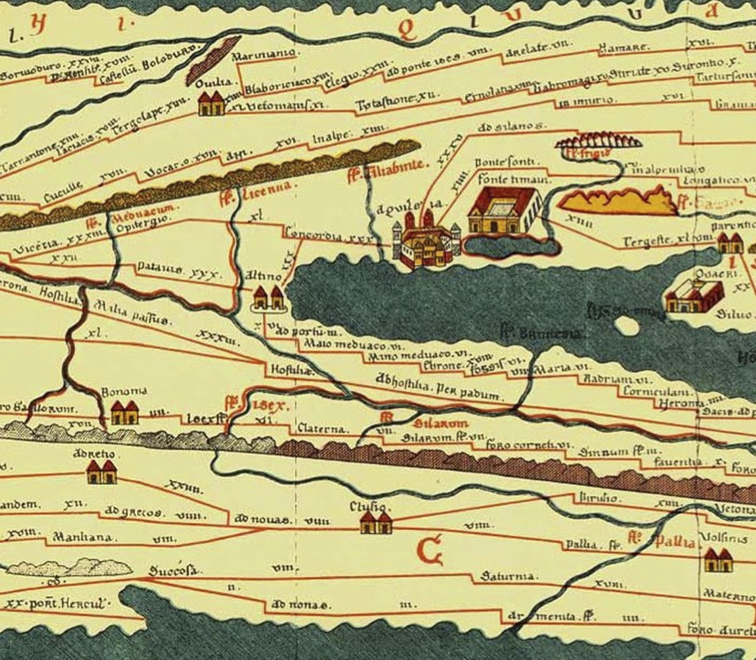
Fig. 1. North-East of Roman Italy: Venetia et Histria. See Altino, Concordia and Aquileia (The Peutinger Map)

Fig. 2. Altino. Remains of harbour wall along the Sioncello canal. The visible remains include wooden poles and stone blocks (Tirelli 2001)

Fig. 3. Altino. Remains of the Roman quay along the river port (SABAP Regione Veneto)
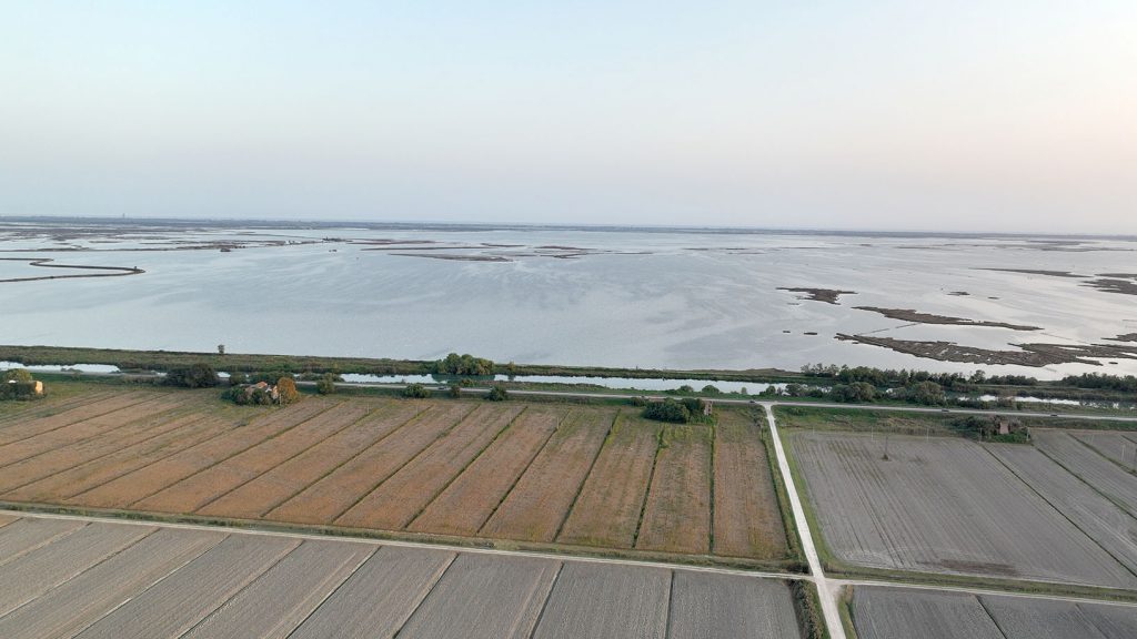
Fig. 4. Aerial view of a sector of the Lagoon of Venice, in Millepertiche, Musile di Piave (VE) (photo: Cirigliano & Ugolini)
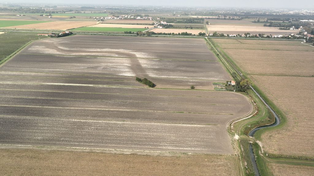
Fig. 5. Aerial view of paleo-rivers and channels, in Millepertiche, Musile di Piave (VE) (photo: Cirigliano & Ugolini)
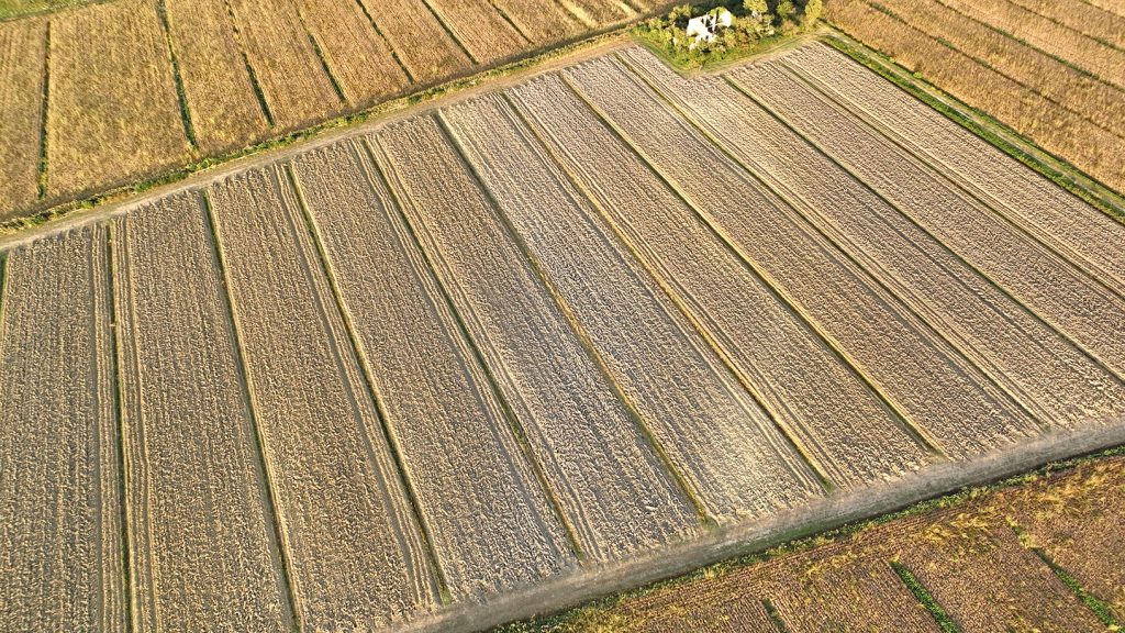
Fig. 6. Aerial photo of evidence related to buried structures, canals, and embankments, in Millepertiche, Musile di Piave (VE) (photo: Cirigliano & Ugolini)
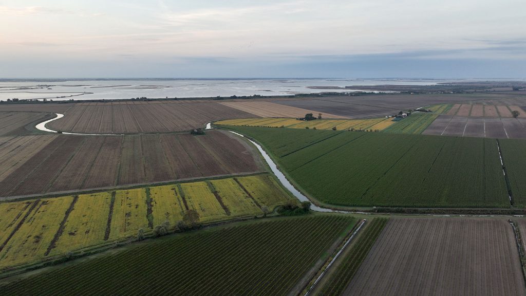
Fig. 7. Aerial view of the lagoonscape of Millepertiche, Musile di Piave (VE) (photo: Cirigliano & Ugolini)
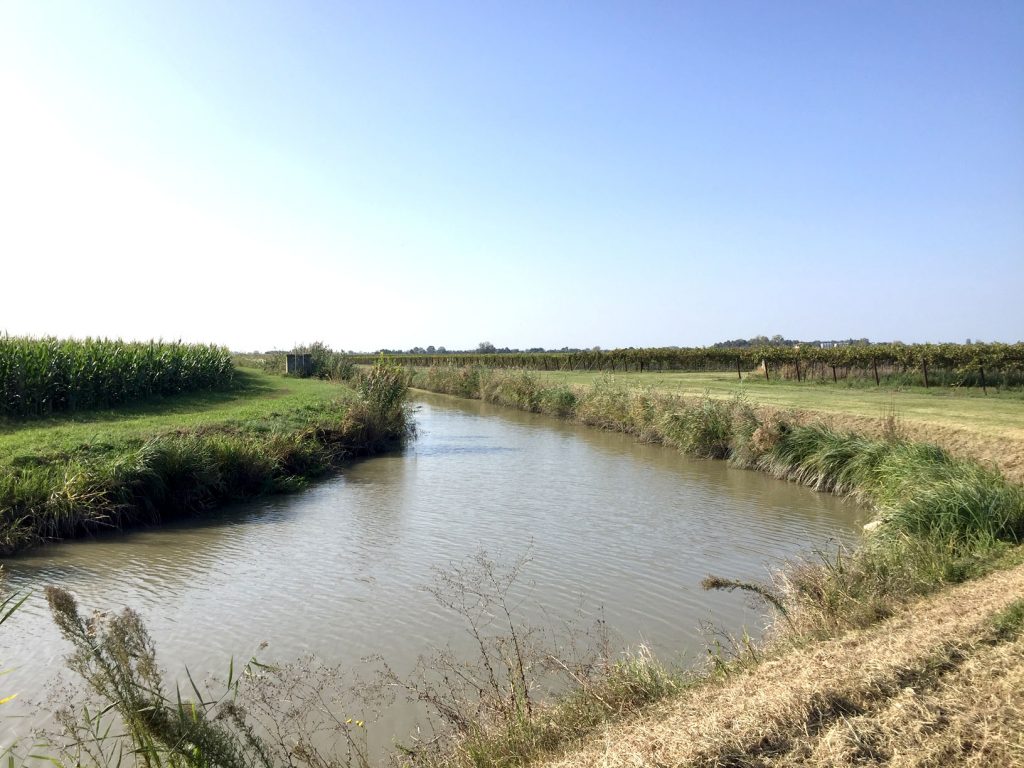
Fig. 8. Details of the lagoonal and riverine environment of Millepertiche, Musile di Piave (VE) (photo: Cirigliano & Ugolini)
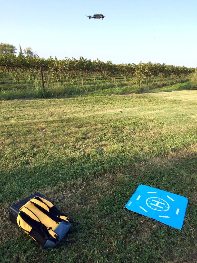
Fig. 9. Aerial survey activity by means of AUVs (2023), in Millepertiche, Musile di Piave (VE) (photo: Cirigliano & Ugolini)
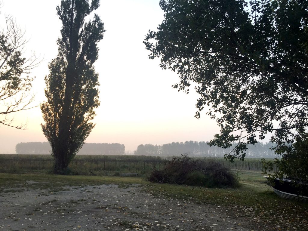
Fig. 10. Details of the rural landscape of Millepertiche, Musile di Piave (VE) (photo: Cirigliano & Ugolini)
![]()
Fig. 11. Field walking survey activity (2024), in Millepertiche, Musile di Piave (VE) (photo: Cirigliano & Ugolini)